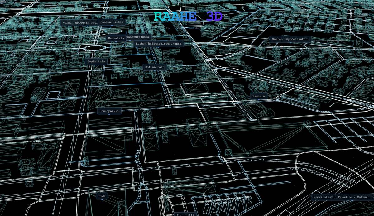
Raahe 3D is a next-generation Digital City platform. It brings the center of Raahe to life as a dynamic 3D city directly in your browser. The project combines geographically detailed 3D models and data-driven intelligence — offering users not just a stunning visual experience, but also seamless access to real-time information about the city’s landmarks.
Smart City Integration
Multi-API Data Network
More than just visuals, the model automatically fetches building data, descriptions, and images from open APIs (Wikipedia, OpenStreetMap), bringing the spatial data alive.
Google Maps Sync
Full integration with modern mapping services. Access Google Maps customer reviews, directions, and opening hours for any building with a single click.
Procedural Generation
Thousands of buildings are optimized and textured on the fly. Advanced loading management with percentage tracking ensures a smooth startup before the stunning “scan” reveal.
Precise GPS Tracking
Built-in coordinate conversion calculates the exact global location (Latitude & Longitude) directly from the 3D space architecture.
Technology Stack
React Three Fiber
The industry-leading 3D solution combining WebGL performance with modern React UI development.
GIS & OpenData
Utilizes datasets from OpenStreetMap for building footprints and highly accurate road modeling.
Custom Shaders
Optimized GLSL shaders and advanced lighting techniques guarantee visual splendor without lag.
Continue Exploration
AI Visualizer Portals
// Broadcast Transmission